島根農科大学
ISSN:0559-8311
ダウンロード数 : ? 件
この文献の参照には次のURLをご利用ください : https://ir.lib.shimane-u.ac.jp/3926
島根農科大学研究報告 15
1967-01-31 発行
陸地造成に伴なう地下水位変動についての一計算法
On the Calculation of the Variation of the Groundwater Table due to the Reclamation by Filling-up in the Coastal Region
藤居 宏一
ファイル
内容記述(抄録等)
Many problems with reclamation by filling-up occur frequently in the coastal region. Some of them are caused by the variation of the groundwater table.
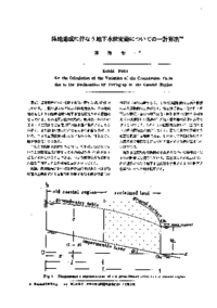
To solve them, the first it should be known the pattern and the variation of the groundwater table after being reclaimed. So, a method is necessary for analysing the variation. Some formulas have, so far, been proposed to analyse the variation. These fit in general cases but these do not always suit the case in question. So, the author derived a useful formula and showed some examples with numerical calculation. Also the result of calculation was tried to compare with others in the same case. The author's method is expressed in short as follows.
The principle to determine the groundwater table is to solve the basic equation (1.4) being derived from Darcy's law and the equation of continuty. Its solution is expressed as a function
Z^2 = P/a(x+C+(1/a)-C'e^<ax>).
The procedure of calculation is the following.
1) To make the system of equations (1) to (4') about constants in (3.0) considering the boundary conditions.
<tt>
┌ C_2 - E^'C^'_2 = K_1 (1)
│ bC_1 - bEC^'_1 - C_3 + EC^'_3 = K_2 (2)
│ - EC^'_1 - C_2 + EC^'_2 = K_3 (3)
│ - C^'_1 = K_4 (4)
└ C_1 C_2 = K^'_4 (4^')
</tt>
2) To solve the system of equations.
3) To apply the determined constants to (3.0).
4) To calculate z (or z^3) for any x using (3.0).
Judging from the result of numerical calculation, the method produces a good approximation in spite of simple procedures.
In other word the method developed by the author is practical to forecast the variation of the groundwater table, that is, it is possible to calculate z for x at any position by the method. This is the most important character. The method is useful for planning land reclamations.
About This Article
Other Article
