| File | |
| Title |
松江試験林の地形図作成
|
| Title |
Topographical-Map of Matsue Experimental Forest attached to Faculty of Agricultire (Shimane University) Used KOKUSAI-PLOTTER
|
| Title Transcription |
マツエ シケンリン ノ チケイズ サクセイ
|
| Creator |
Yasui Hitoshi
Fujie Isao
|
| Source Title |
島根大学農学部研究報告
Bulletin of the Faculty of Agriculture, Shimane University
|
| Volume | 2 |
| Start Page | 105 |
| End Page | 107 |
| Journal Identifire |
ISSN 0370940X
|
| Descriptions |
Abstract
We carried out aerial photgrammetry for Matsue-Experimental Forest by wide angle vertical photography.
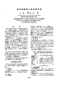
First of all, for decide on final results of the contfoll points from list of known points(Trianglation station and bench mark) conducted the field works, and the results was shown Table 2. The mapping used the diapositives(1 : 20,000) and KOKUSAI PLOTTER of KP style mapping-machine. After put the relative orientation by GRUBER's method and the absolute orientation, the contour tracing were practiced at scale of 1 : 2500 (interval of conter line is 5 m) as next Figure. |
| Language |
jpn
|
| Resource Type | departmental bulletin paper |
| Publisher |
島根大学農学部
Shimane University, Faculty of Agriculture
|
| Date of Issued | 1968-12-15 |
| Access Rights | open access |
| Relation |
[NCID]
AN00108015
|